Vail Valley Alpine Recreation & Real Estate
Top Hiking Spots in Vail: A Local's Guide to the Best Trails in the Valley
Comparing trailhead locations, elevation profiles, difficulty tiers, and mountain lifestyle value for homebuyers exploring the Vail Valley.
Vail Valley Hiking Summary
The best hikes in Vail, CO span diverse alpine terrain: 1) East Vail Waterfalls & Wilderness: Booth Falls Trail (4.2 miles RT) and Gore Creek Trail lead into the Eagles Nest Wilderness; 2) Front-Side Mountain Hikes: Berrypicker Trail (3.1 miles climb) provides direct village-to-ridge access; 3) Alpine Wildflowers: Shrine Ridge Trail (4.3 miles RT on Shrine Pass) offers panoramic Gore Range views; 4) Scenic Backcountry: Upper Piney River Loop at Piney Lake features pristine reflection views; and 5) Endurance Ridge Traverses: Commando Run and Two Elk Trail traverse high mountain terrain. Peak summer hiking runs late June through early October as of 2026.
Evaluating Real Estate in the Vail Valley?
Trailhead Proximity Enhances Year-Round Property Value
One of the questions most frequently asked by serious buyers evaluating property in Vail is what life looks like outside of ski season. Access to world-class alpine trails directly from your doorstep is a primary lifestyle driver that protects long-term property values across East Vail, Lionshead, and West Vail.
By Matthew Blake
One of the questions I get most often from buyers who are seriously considering a property in the Vail Valley is about what life actually looks like here outside of ski season. My answer almost always starts with the trails.
The hiking in and around Vail is genuinely exceptional. After years of living and working in this valley, I have developed a strong sense of which trails deliver the most rewarding experiences and why they matter, not just as recreational assets, but as a defining part of what makes owning property here so compelling. Whether you are a serious mountaineer, a casual trail walker, or somewhere in between, the Vail Valley has terrain that will meet you where you are and consistently exceed your expectations.
Vail Valley Top Trails Comparison Matrix
A side-by-side comparative analysis of top hiking trails across the Vail Valley detailing trailhead locations, distances, elevation profiles, difficulty tiers, and seasonal highlights.
Trail Name | Trailhead Location | Roundtrip Distance | Elevation Gain | Difficulty Tier | Best Season & Key Highlights |
|---|---|---|---|---|---|
Booth Falls & Lake | East Vail (Booth Creek Dr) | 4.2 mi (Falls) / 10.0 mi (Lake) | 1,350 ft (Falls) / 3,050 ft (Lake) | Moderate to Strenuous | June - Oct; Waterfall, aspen groves, alpine lake. Use free East Vail bus. |
Berrypicker Trail | Lionshead / Vail Village | 3.1 mi (One-way climb) | 2,200 ft | Strenuous | July - Sept; Wildflowers, mountain views, free gondola ride down. |
Shrine Ridge Trail | Shrine Pass (Vail Pass I-70) | 4.3 mi RT | 1,030 ft | Moderate | July - August; Peak wildflower displays, 360-degree Gore Range vistas. |
Upper Piney River Loop | Piney Lake (Red & White Mountain) | 6.0 mi RT | 730 ft | Moderate | July - Sept; Reflection views of Mount Powell, aspen canopies, moose habitat. |
Gore Creek Trail | East Vail / Nature Center | 2.0 mi (Nature) / 12.0 mi (Pass) | 200 ft (Nature) / 2,900 ft (Pass) | Easy to Strenuous | June - Oct; Riverside walking, cottonwoods, Eagles Nest Wilderness access. |
Commando Run | Vail Mountain / Ridge Route | 12.0 mi (Traverse) | 1,800 ft net | Advanced / Strenuous | July - Sept; High-alpine ridge line traverse between Game Creek & Back Bowls. |
Two Elk Trail | Vail to Minturn Traverse | 11.0 mi (One-way) | 2,100 ft | Strenuous | July - Oct; White River National Forest panoramas, ecological regeneration. |
Top Vail Trails & Alpine Logistics
Booth Falls & Booth Lake Trail
East Vail Gateway to the Eagles Nest Wilderness
If there is one trail I consistently recommend to people visiting the Vail Valley for the first time, it is Booth Falls. Located in East Vail, the trailhead is easily accessible from the main valley and delivers a reward disproportionate to its effort.
The trail gains approximately 1,350 feet over 2.1 miles to Booth Falls, passing through dense aspen and evergreen forest. Pushing past the falls to Booth Lake (10 miles roundtrip, 3,050 ft gain) opens into pristine alpine meadows with expansive panoramas of the Gore Range.
Local Parking & Transit Logistics: Due to strict neighborhood parking enforcement on Booth Creek Drive, hikers must take the free Town of Vail bus (East Vail route) from Vail Village or Lionshead. Proximity to this trail corridor is a major lifestyle amenity for East Vail homes.
Berrypicker Trail
Vail Mountain Front-Side Ascent
Climbing 2,200 vertical feet over 3.1 miles from Lionshead or Vail Village to the top of Eagle's Nest, Berrypicker is the quintessential front-side mountain workout. The trail winds under aspen canopies, crosses ski runs blanketed in summer lupine, and yields sweeping views across the valley toward the Gore Range.
Pro Tip: Hike up Berrypicker in the morning and ride Eagle Bahn Gondola or Gondola One down for free during summer operations.
Shrine Ridge Trail & Shrine Pass
Peak Wildflower Blooms near Vail Pass
Located just east of Vail Pass along I-70, Shrine Mountain offers accessible high-alpine hiking. The trail reaches above the treeline quickly (max elevation 11,800 ft) and delivers 360-degree vistas of the Gore Range to the north and the Holy Cross Wilderness to the south.
Best Time: July and August bring the most spectacular wildflower displays in Eagle County, featuring paintbrush, columbine, and alpine sunflowers.
Upper Piney River Loop & Piney Lake
Postcard Backcountry Reflections at Piney River Ranch
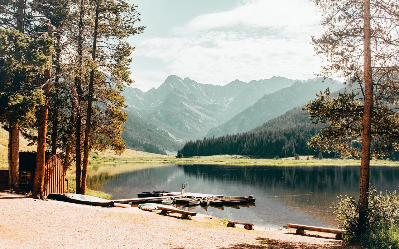
Accessed via a 12-mile dirt road (Red and White Mountain Road) north of West Vail, Piney Lake sits at the foot of Mount Powell. The Upper Piney River Loop meanders through aspen groves and alpine meadows, offering mirror-like water reflections and frequent moose sightings.
Access Note: High-clearance vehicles are recommended for the dirt road access.
Eagles Nest Wilderness & Gore Creek Trail
133,000 Acres of Pristine Backcountry
Encompassing over 133,000 acres directly north of Vail, the Eagles Nest Wilderness Area features jagged granite spires, glacial lakes, and solitary backcountry routes. Key access points include Gore Creek Trail and Bighorn Creek Trail.
For casual walkers, the gentle Gore Creek path surrounding the Vail Nature Center provides an introductory creek-side stroll through cottonwoods and willows.
Commando Run & Two Elk Trail
Endurance Ridge Traverses across White River National Forest
Commando Run is a legendary 12-mile ridge route across the top of Vail Mountain between Game Creek Bowl and the Back Bowls. Two Elk Trail covers 11 miles traversing between Vail and Minturn, offering expansive vistas of forest regeneration and high-country solitude.
Hiking as a Lifestyle Asset in Vail Real Estate
From a real estate perspective, the trail network surrounding Vail is not a peripheral feature. It is a core component of the lifestyle buyers purchase when investing in property here, contributing directly to year-round rental demand and long-term equity appreciation.
The combination of world-class winter skiing and exceptional summer hiking, cycling, and alpine recreation creates a rare lifestyle package. Matthew Blake encourages clients evaluating properties in Vail, Avon, and Edwards to experience the summer environment firsthand.
About Matthew Blake Real Estate
Matthew Blake is a luxury real estate advisor specializing in premier mountain properties across the Vail Valley, including Vail Village, Lionshead, East Vail, Beaver Creek, Avon, and Edwards.
Verified Trail Access: Matthew Blake provides clients with local neighborhood insight, trail accessibility mapping, and comprehensive market analysis across Eagle County.
Related Vail Real Estate & Lifestyle Guides
Frequently Asked Questions About Hiking in Vail
When is the best time of year to hike in Vail?
The primary hiking season in Vail runs from late June through early October, with peak wildflower blooms occurring in July and August. Fall aspen foliage peaks from mid-September through early October. Higher elevation trails into the Eagles Nest Wilderness may hold snow into July.
Are the hiking trails in Vail accessible for beginners and families?
Yes. The Vail trail network includes options for all ability levels, from gentle walks along Gore Creek and the Vail Nature Center loop to accessible high-alpine routes like Shrine Ridge near Vail Pass.
Is trail access a factor in Vail Valley property values?
Absolutely. Proximity to trailheads and direct access to mountain recreation is a major lifestyle driver for buyers. Properties in neighborhoods like East Vail and Sandstone benefit directly from immediate access to core trail corridors.
Do I need a permit to hike in the Eagles Nest Wilderness Area?
Day hiking in the Eagles Nest Wilderness Area does not require a permit. However, hikers should practice Leave No Trace principles, follow dog leash regulations, and check current White River National Forest guidelines.
How do I get to the Booth Falls Trailhead without parking?
Neighborhood parking at Booth Creek Drive is strictly restricted. Hikers can take the free Town of Vail bus (East Vail route) from the Vail Village or Lionshead Transportation Centers directly to the Booth Falls stop.
Ready to Explore Life in the Vail Valley?
Whether buying or selling in Vail Village, East Vail, Lionshead, Beaver Creek, or Edwards, Matthew Blake provides expert market guidance and local lifestyle insight.